
Lead Logistics Coordinator
NOAA Coral Reef Ecosystems Division
Pacific Islands Fisheries Science Center
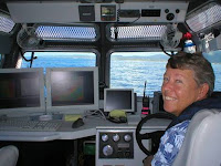
Scott Ferguson leads the Coral Reef Ecosystem Division’s benthic habitat mapping team, a group that is responsible for developing maps of the coral reef environment throughout Hawaii, Guam, the Mariana Islands, American Samoa, and other US-affiliated Pacific islands. These maps are used by ocean resource managers and scientists throughout the Pacific to help understand coral reef processes. Since graduating from the Massachusetts Institute of Technology in 1978, Ferguson has participated in dozens of surveys around the world in support of geophysical research, nautical charting, and underwater cable installations. He is particularly interested in the design, development, and installation of shipboard oceanographic and mapping systems. On this cruise, he has coordinated six teams of scientists to create bathymetric maps and survey fish populations.
 Joyce Miller is an oceanographer with the Coral Reef Ecosystem Division (CRED) and the University of Hawaii’s Joint Institute for Marine and Atmospheric Research. On the first part of this cruise, she is in charge of night operations and coordination of multibeam mapping. She will return to Hawaii in mid-cruise to continue coordination of CRED’s Coral Reef Ecosystem Monitoring Report for the Mariana Archipelago – 2003 to 2007, which is due for publication in July 2010.
In her 35 years of oceanographic work, Joyce has specialized in multibeam mapping, working with NOAA, the Naval Oceanographic Office, Science Applications International Corp., and a number of universities. She holds a Master of Science in Education from Indiana University and conducted graduate work in Marine Geology at the University of Hawaii. She holds an offshore hydrographer’s certificate from the American Congress on Surveying and Mapping. In the course of her career, she has helped to introduce multibeam technologies for use in nautical charting and habitat mapping. She has spent over 15 years at sea on small boats and ships, including 4 years of cruising in the Caribbean before joining CRED. Joyce lives aboard a 50’ sailboat in Honolulu with her husband and cat.
 John Rooney is a Coastal and Marine Geomorphologist, and the Habitat Mapping Team Lead. He has worked for the NOAA Pacific Island Fisheries Science Center in CRED’s Pacific Island Benthic Habitat Mapping Center for seven years. He is primarily responsible for mapping biologically important sea-floor characteristics, using multibeam data and optical imagery obtained from camera sled tows, remotely operated vehicles, and other sources. Rooney holds a PhD in coastal geology from the University of Hawaii and an MS in biological oceanography from the same institution. He has lived in Hawaii for more than 20 yrs and worked in, on, or around the ocean for most of that period. He enjoys scuba diving on deeper coral reefs around the islands with a closed circuit rebreather.
 My name is Michael Wayne Akridge. I am 21 years of age. I was born in National City, California, but spent most of my life in Georgia and several other states. After graduating from high school in Georgia, I left to study at the University of Hawaii at Manoa. I started working for CRED/NOAA as a student assistant and I now work permanently part-time. My duties have always been focused on helping the mapping team get their data on the web. I have been handling the mapping teams final products for years and now I got a chance, not only see how it is collected, but help gather the data as well. Technology is my strong suite, but I am no stranger to the outdoors. I love hiking, soccer, video games, music, movies, and so much more.
 Frances Lichowski is currently working as a senior seabed mapping specialist with NOAA PIFSC CRED. Born and raised in Germany she grew up on the North Sea coast. After finishing high school she followed her fascination with the ocean and entered the Kiel University for her B.S. in Geology and M.Sc. in Marine Geology and Geophysics. Back in Kiel, she worked as a research assistant and research diver for many years in geoscience and archaeology. Away from work, you will find her playing in the ocean. She loves to spend most of her time surfing, racing sailboats and outrigger canoes.
 Jonathan Weiss is a seafloor mapping specialist with NOAA PIFSC CRED. He was born in western Pennsylvania and as a child lived in Taiwan, Hong Kong, Virginia, Ohio, and Arizona. Jonathan attended the College of William and Mary in Virginia and received his B.S. in Geology in 2000. He then moved to Hawaii and received his M.S. in Marine Geology and Geophysics from the University of Hawaii in 2004. Jonathan is currently pursuing his PhD at UH. During his time as a student in Hawaii, Jonathan began to work with marine multi-channel seismic, bathymetry, and backscatter data to better understand geologic processes. Since graduating from UH Jonathan has worked with CRED and has played a major role in seafloor mapping activities in the Pacific Ocean on board the NOAA Ship Hiialakai and the NOAA survey launch R/V AHI. His main duties include multibeam bathymetry and backscatter data acquisition, processing, and interpretation. Currently, his research focuses on combining geophysical and optical data to create seafloor habitat maps. Away from the office, Jonathan is an avid surfer and outdoorsman and he enjoys preparing vegetarian meals with his girlfriend and roommate.
 Jake Asher is a marine ecosystem specialist with NOAA PIFSC CRED in Honolulu, HI. He is originally from Washington DC, but spent many summers along the eastern seaboard where his interest in marine science grew. He has a Bachelors of Science from the University of Michigan, and a Masters of Environmental Management from the Duke University Nicholas School of Environmental and Earth Sciences. From 1995 – 2002, Jake was involved in a variety of marine science research programs, including phytoplankton/cyanobacteria research at the Heinz Steinitz Marine Biological Laboratory in Israel, a fellowship at the Bermuda Institute of Ocean Sciences examining coral disease frequencies, a Sister Exchange Program between the Chugach National Forest and Magadan Marine Preserve in Russia, and had a contract as a NOAA Fisheries Observer in Alaska. Jake’s current interests focus on large-scale benthic habitat assessments using towed-diver surveys. For the current cruise, he is working as the CRED Science Liaison to CNMI and the Acting Liaison to Guam, assisting with BotCam/BRUV research activities, and working as the cruise photographer.
 Steven Lindfield is the cruise lead for the BRUVs deployments, and a PhD candidate out of the University of Western Australia. His focus of research is the examination of deep water coral reef assemblages and the effects of fishing pressure. Steven is a graduate from the University of Newcastle, and award recipient of the 2008 Australasian Rolex Scholar for the Our World Underwater Scholarship Society.

Mark “Sparky” Anderson Priest is a current graduate student at the University of Guam, sponsored by Jenny McIkwain. His master’s thesis is focused on the connectivity between rabbitfish populations along the Western Pacific. A previous degree was awarded in Biology (BSC) out of the University of York in the United Kingdom. Mark is working with the BRUVs project for the duration of the cruise.
 Mary Donovan is the cruise lead for the BotCam deployments, and is a current graduate student out of the University of Hawaii studying fisheries ecology. She has been employed by CRED since 2008. Mary previously worked for the Partnership of Interdisciplinary Studies of Coastal Oceans with UC Santa Barbara, where she also received a BS in Biology.
 Erica Fruh began working for the Fishery Resource Analysis and Monitoring Division of the Northwest Fisheries Science Center in 2001 as a member of the survey team. She spends the majority of the field season aboard chartered commercial fishing vessels conducting surveys of the groundfish resources on the West Coast as a field party chief. Erica also researches the distribution of marine debris in the waters of the West Coast and life history characteristics of West Coast groundfish. Erica is also a member of the Division team developing AUV (Autonomous Underwater Vehicle) technology for monitoring groundfish in rocky habitats on the West Coast. She earned her B.S. in Marine Biology from Auburn University, and her M.S. in Marine Resource Management from Oregon State University.
 Elizabeth Clarke is the Division Director of the Fishery Resource Analysis and Monitoring Division at the Northwest Fisheries Science Center. The mission of the FRAM division is to provide the scientific basis for the management of West Coast Groundfish stocks and their ecosystems. Dr. Clarke joined NOAA Fisheries in 1998 in the Office of Science and Technology where she focused on developing new science quality assurance and fisheries oceanography programs. Before joining NOAA Fisheries, she was on the faculty of the Rosenstiel School of Marine and Atmospheric Science at the University of Miami. During sabbatical leave from the University in 1996-1997, she was the associate director of the Ocean Studies Board of the National Research Council (NRC), National Academy of Sciences where she was also the study director for several congressionally mandated NRC studies. Elizabeth has a Ph.D. from UCSD Scripps Institution of Oceanography, an M.S. in fisheries biology from the University of Alaska and a B.S. in biological science from the University of California, Irvine.
 Curt Whitmire is a spatial analyst in the Fishery Resource Analysis & Monitoring Division of the Northwest Fisheries Science Center (NWFSC). He began working at the NWFSC in January 2003. Curt received an M.S. in Marine Resource Management from Oregon State University in 2003 and a B.S. in Biology from Arizona State University in 1997. Curt provides technical support for programs in FRAM, conducting spatial analyses of data associated with west coast groundfish surveys and assessments. Recently, Curt joined the Center’s Autonomous Underwater Vehicle (AUV) team that is developing survey methods for habitats not accessible to traditional sampling gears. Curt also maintains a database on occurrences of deep-sea corals and other biogenic structure-forming invertebrates off the west coast of the U.S. which helps promote conservation of these vulnerable resources.
 Chris Murphy graduated from Franklin W. Olin College of Engineering, with a Bachelor of Science, Electrical and Computer Engineering, in May 2006. Chris is now a graduate student in an electrical engineering program run jointly by Woods Hole Oceanographic Institute and Massachusetts Institute of Technology. While taking courses, he also works with a team that uses a robot, the SeaBED Autonomous Underwater Vehicle (AUV), to map the ocean floor. The device takes thousands of photographs to create a panorama of the bottom of the sea. It helps measure, for example, how the health of coral reefs has changed as ocean temperatures have risen. Chris earned a scuba certification while still in high school.
 Jeff Anderson works for NOAA Fisheries' Coral Reef Ecosystem Division's (CRED) Pacific Islands Benthic Habitat Mapping Center where he is a member of the AUV team. Prior to joining CRED, he worked on NOAA’s Florida Keys National Marine Sanctuary’s Damage Assessment and Resource Protection (DARP) team stationed in Key Largo, FL. In that role, Jeff specialized in conducting benthic habitat surveys to document injuries to natural resources and to collect data for the long-term monitoring of vessel grounding restoration sites. Additionally, Jeff helped the Sanctuary maintain a network of 35 subsurface water temperature monitoring devices.
In addition to his work with NOAA, Jeff, a lifelong naturalist, is a freelance underwater photographer and has lived, worked, and dove throughout the southern Atlantic Ocean and Caribbean Sea region. Highlighting nature's stirring beauty, his text and photographs have been featured in national and international SCUBA diving magazines and ad campaigns. Jeff shares his passion for the outdoors with others, narrating his experiences in multimedia presentations to photography, nature, and SCUBA diving clubs. With over 16 years of active SCUBA diving experience, he has been instructing others about the beauty of the underwater realm and led several dive charters. While working on Little Cayman, Jeff volunteered repeatedly with the Cayman Islands Department of Environment to assist their marine turtle migration studies as well as monitoring active marine turtle nesting beaches.
Jeff has been a NOAA Working Diver since 2008, NOAA Scientific Diver since April 2000, and a PADI Master SCUBA Diver Trainer since October 1997.
Jeremy Taylor works for NOAA Fisheries' Coral Reef Ecosystem Division's (CRED) Pacific Islands Benthic Habitat Mapping Center where he is the AUV project lead. Prior to joining CRED, Jeremy was the Survey Technician onboard the NOAA Research Vessel Hi'ialakai. He has extensive background conducting multibeam mapping surveys in the central and northern Pacific Ocean.
 Viv Blyth-Skyrme is a marine ecosystem research specialist with NOAA PIFSC CRED. She was born in Massachusetts but grew up in England, where she received her BSc in Biology at the University of Sussex, Brighton and her MSc in Marine Environmental Protection at the University of Wales, Bangor. Back in England, she previously worked on surveying areas of conservation importance around the UK, providing scientific advice to the government on locating Marine Protected Areas. She now works with CRED’s mapping team, specializing in underwater video surveys and supporting the team’s mapping operations. Outside of work she enjoys diving, snorkeling, kayaking, running and anything else that involves being outside in Hawai’i.
 Lieutenant Tony Perry III, graduated in 2004 from California State Univ. Monterey Bay with a BS in Earth Systems, Science, and Policy with a concentration of Marine and Coastal Ecology. After graduation LT Perry joined the NOAA Corps. He spent 2.5 years assigned to the NOAA ship Gordon Gunter out of Mississippi, before being assigned to the Pacific Island Fisheries Science Center, Coral Reef Ecosystems Division (CRED) in Hawaii. LT Perry will complete his assignment at CRED in July 2010.
In her 35 years of oceanographic work, Joyce has specialized in multibeam mapping, working with NOAA, the Naval Oceanographic Office, Science Applications International Corp., and a number of universities. She holds a Master of Science in Education from Indiana University and conducted graduate work in Marine Geology at the University of Hawaii. She holds an offshore hydrographer’s certificate from the American Congress on Surveying and Mapping. In the course of her career, she has helped to introduce multibeam technologies for use in nautical charting and habitat mapping. She has spent over 15 years at sea on small boats and ships, including 4 years of cruising in the Caribbean before joining CRED. Joyce lives aboard a 50’ sailboat in Honolulu with her husband and cat.


 Jonathan Weiss is a seafloor mapping specialist with NOAA PIFSC CRED. He was born in western Pennsylvania and as a child lived in Taiwan, Hong Kong, Virginia, Ohio, and Arizona. Jonathan attended the College of William and Mary in Virginia and received his B.S. in Geology in 2000. He then moved to Hawaii and received his M.S. in Marine Geology and Geophysics from the University of Hawaii in 2004. Jonathan is currently pursuing his PhD at UH. During his time as a student in Hawaii, Jonathan began to work with marine multi-channel seismic, bathymetry, and backscatter data to better understand geologic processes. Since graduating from UH Jonathan has worked with CRED and has played a major role in seafloor mapping activities in the Pacific Ocean on board the NOAA Ship Hiialakai and the NOAA survey launch R/V AHI. His main duties include multibeam bathymetry and backscatter data acquisition, processing, and interpretation. Currently, his research focuses on combining geophysical and optical data to create seafloor habitat maps. Away from the office, Jonathan is an avid surfer and outdoorsman and he enjoys preparing vegetarian meals with his girlfriend and roommate.


Mark “Sparky” Anderson Priest is a current graduate student at the University of Guam, sponsored by Jenny McIkwain. His master’s thesis is focused on the connectivity between rabbitfish populations along the Western Pacific. A previous degree was awarded in Biology (BSC) out of the University of York in the United Kingdom. Mark is working with the BRUVs project for the duration of the cruise.


In addition to his work with NOAA, Jeff, a lifelong naturalist, is a freelance underwater photographer and has lived, worked, and dove throughout the southern Atlantic Ocean and Caribbean Sea region. Highlighting nature's stirring beauty, his text and photographs have been featured in national and international SCUBA diving magazines and ad campaigns. Jeff shares his passion for the outdoors with others, narrating his experiences in multimedia presentations to photography, nature, and SCUBA diving clubs. With over 16 years of active SCUBA diving experience, he has been instructing others about the beauty of the underwater realm and led several dive charters. While working on Little Cayman, Jeff volunteered repeatedly with the Cayman Islands Department of Environment to assist their marine turtle migration studies as well as monitoring active marine turtle nesting beaches.
Jeff has been a NOAA Working Diver since 2008, NOAA Scientific Diver since April 2000, and a PADI Master SCUBA Diver Trainer since October 1997.
Jeremy Taylor works for NOAA Fisheries' Coral Reef Ecosystem Division's (CRED) Pacific Islands Benthic Habitat Mapping Center where he is the AUV project lead. Prior to joining CRED, Jeremy was the Survey Technician onboard the NOAA Research Vessel Hi'ialakai. He has extensive background conducting multibeam mapping surveys in the central and northern Pacific Ocean.


