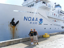
Autonomous Underwater Vehicle Operations during NOAA Ship Oscar Elton Sette Cruise SE-10-02
by Jeff Anderson
AUV SeaBED At Work Underwater
The operations described in cruise instruction SE-10-02 will be conducted with a SeaBED-class Autonomous Underwater Vehicle (AUV). The SeaBED-class AUV is unlike other, more traditional AUV’s, in that its twin-hull design provides greatly enhanced stability for low-speed photographic surveys. Built by Woods Hole Oceanographic Institute (WHOI), SeaBED is designed to autonomously follow the terrain approximately 3-4 meters (m) above the sea floor, collecting high resolution color imagery while maintaining a forward speed of .25 – .5 m/sec. SeaBED is approximately two meters long and weighs nearly two-hundred kilograms. It has two main pressure housings, a top hull and a bottom hull. The CPU electronics are located in the top hull, and the batteries, cameras, and sensors are located in the bottom hull, and all are connected by wet cabling that is routed through vertical struts. With a maximum depth range of 2,000 m, and maximum single-dive time of 6 – 8 hours, SeaBED can be used to survey habitats ranging from shallow coral reefs to deep groundfish environments.
Left: Jeff and Chris program the AUV
The AUV is programmed while still aboard the ship. Programming parameters include navigational waypoints, speed, altitude to maintain above the seafloor, and frequency of photographs. Once submerged, the AUV does not resurface until the end of its mission. An RD Instruments 1200 kHz Doppler Velocity Log, iXSea Octans Inertial Navigation Unit, and Paroscientific Depth Sensor provide the data necessary for the vehicle’s autonomous navigation. The AUV does report its position to the ship periodically in telemetry messages via acoustic MODEM. Additionally USBL tracking shows range and bearing between the ship and AUV during the mission. If any of these telemetry messages indicate an unexpected change in the AUV's planned mission, the mission can be aborted via acoustic MODEM message, resulting in the AUV returning to the surface for recovery.
Left: Lower hull of the AUV without its protective housing
The SeaBED AUV carries two 5 megapixel, 12 bit dynamic range Prosilica GigE strobe-lighted cameras, one perpendicularly downward-looking and one forward looking (~35°). Imagery from the downward-looking camera can be analyzed to characterize the benthic communities while the forward-looking camera imagery provides a slight side view to aid fish species identification. Combined, these 2 imagery data sets can reveal information about fish species composition and local population, along with the benthic communities around which they associate. An onboard Seabird model 49 FastCat CTD records temperature and salinity data along the AUV track, providing further environmental insight
Scientific Objectives
Research is needed to develop and test newer methods to provide alternative ways of collecting essential information or to enable collection of data under specific constraints. In cases where it is desirable to limit the sampling mortality in certain populations, new methods may make it feasible to collect some kinds of data without capture or removal of the fish. The essential need is to be able to collect all data required for robust stock assessments. One of the primary purposes of the cruise is to calibrate fish density between a variety of fishery independent methods, including fisheries echosounders, baited camera stations, and AUV surveys.
Right: Erica and Jeremy process the data collected by the AUV
During the February 11 – 25 leg of this cruise (cruise leg 1), we deployed an autonomous underwater vehicle (AUV) within 30 – 200 m depths to collect digital imagery of the benthos and associated bottom fish communities. Site selection was based on high-resolution multibeam echosounder bathymetric data collected during this cruise, along with data compiled from other sources. Data collected with the AUV can be used to ground truth and optically characterize the benthic habitats along with providing a fishery-independent stock assessment for bottom fish species.
SeaBed Autonomous Underwater Vehicle Characteristics/Specifications
Maximum Depth 2,000 m (USBL transmitter only rated to 1,500 m)
Endurance Maximum of 8 hours at cruising speed of 0.5 knot (.25 m/s) with all onboard sensor, communications, and navigation equipment on-line.
Vehicle power 1.6kWHr Li Ion rechargeable batteries
Operational Salinity Range 0-37 ppt
Operational Temperature Range -2o to +38
Data Storage 120 Gigabyte hard drive
Additional Payload Space Plenty of additional space, buoyancy, computational power, disk space will exist for the integration of other sensors such as side scan sonars, small multi-beam and a small mass spectrometer.
Navigation Equipment Sensors • RDI 1200 kHz Doppler Velocity Log
• iXSea Octans Inertial Navigation Unit.
Navigation Pressure Transducer 2,000 m rated Paroscientific Depth Sensor integrated into the vehicle navigation stream
Additional Acoustic Navigation LinkQuest TrackLink 1510BH USBL
Optical Imaging System Two 5 Megapixel, 12 bit dynamic range Prosilica GigE strobe-lighted cameras, one downward looking and one forward (30°).
CTD Sensor Seabird model 49 FastCat CTD
Subsurface Communication WHOI 256008 acoustic micromodem
Surface Communication FreeWave FGR-115RC RF radio modem with minimum range of 2 km


